A drone flight plan is a set path a drone flies. It has spots to go, how high, how fast. And where the camera points. It also has safety checks. This makes sure flights are safe and follow laws. It helps pilots miss things in the way and use battery well.
Term
Drone flight plan
Category
Process
A drone flight plan is a structured blueprint that guides an unmanned aerial vehicle (UAV) through a specific path while performing tasks like filming, photography. Or surveying. Unlike manual piloting, where the operator controls the drone in real time, a flight plan automates the drone’s movements, altitudes, speeds. And camera angles. This automation ensures consistency, especially for complex shots or repetitive tasks, such as capturing aerial footage of landscapes or tracking moving subjects. Flight plans are essential for professional productions, where precision and safety are critical.
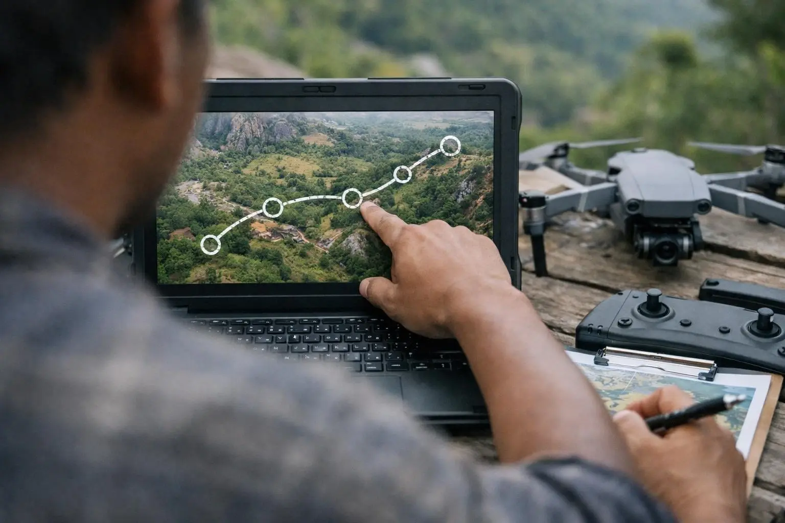
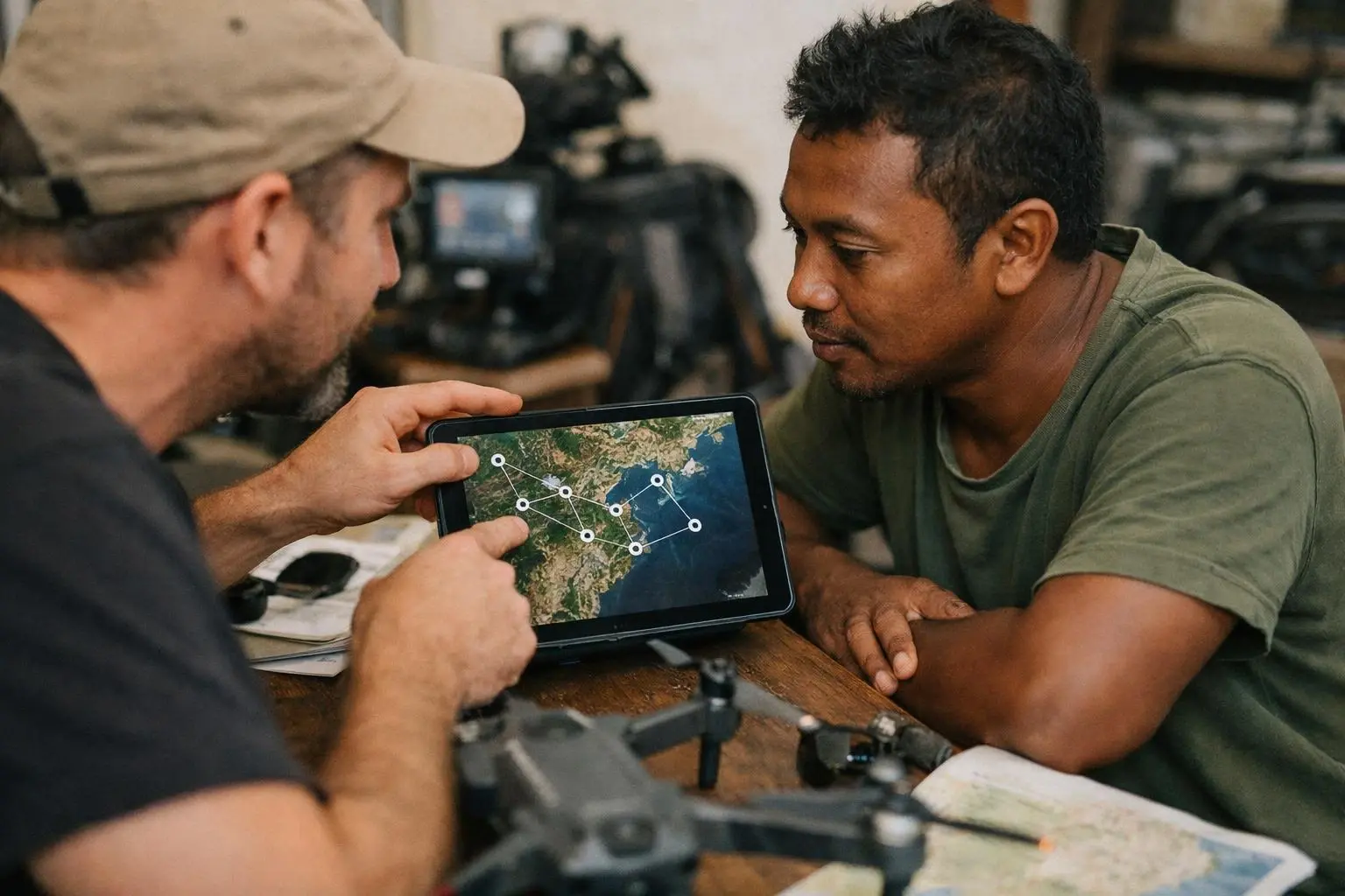
Flight plans are created using specialized software that allows operators to plot waypoints on a digital map. Each waypoint defines a location, altitude. And action, such as starting or stopping recording, adjusting the camera angle. Or changing speed. The software calculates the optimal path between waypoints, accounting for obstacles, wind conditions. And battery life. This level of detail helps operators avoid mid-flight errors, such as running out of battery or colliding with structures, which could damage the drone or disrupt filming.
Creating a drone flight plan begins with defining the purpose of the flight, such as filming a scene or conducting an aerial survey. Operators use mapping software to plot waypoints, which are specific coordinates the drone will follow. Each waypoint includes details like altitude, speed. And camera settings, such as tilt or zoom. The result matters. The software then generates a route that connects these waypoints, ensuring smooth transitions between them. For example, a flight plan might instruct the drone to ascend to 50 meters, fly forward at 10 meters per second. And tilt the camera downward to capture a specific angle.
Flight plans can be executed manually or automatically, depending on the drone’s capabilities and the operator’s preferences. Some drones support autonomous flight, where the operator uploads the plan and the drone follows it without further input. That means particularly useful for long or complex shots, such as tracking a moving vehicle or filming a large area. Operators can also adjust the plan in real time if conditions change, such as unexpected weather or obstacles. Safety features, like geofencing, can be included to prevent the drone from flying into restricted areas.
Measurement and evaluation of a flight plan focus on accuracy, efficiency. And compliance. Operators review the drone’s telemetry data after the flight to ensure it followed the planned route, maintained the correct altitude. And captured the intended footage. Software tools can overlay the actual flight path on the planned route to identify deviations, which may indicate issues like wind interference or technical malfunctions. Compliance with local regulations, such as altitude limits or no-fly zones, is also verified to avoid legal penalties.
A well-designed drone flight plan is crucial for achieving professional-quality aerial footage while minimizing risks. Without a plan, operators rely solely on manual piloting, which can lead to inconsistencies in camera angles, speeds. Or framing, especially in complex shots. Flight plans ensure that every take is repeatable, which is essential for productions that require multiple angles or retakes. They also help operators stay within legal limits, such as altitude restrictions or no-fly zones, reducing the risk of fines or confiscation of equipment.
Flight plans also improve efficiency by optimizing battery life and reducing the need for manual adjustments during filming. For example, a plan can calculate the shortest route between waypoints, allowing the drone to conserve power and extend its flight time. This is particularly important in remote or challenging environments, such as Madagascar’s diverse landscapes, where recharging opportunities may be limited. And flight plans can include safety checks, such as obstacle avoidance, to prevent collisions with trees, buildings. Or other structures.
Drone flight plans are most critical in situations where precision, safety. And compliance are non-negotiable. For example, filming in urban areas or near airports requires strict adherence to regulations, such as altitude limits and no-fly zones. A flight plan ensures the drone stays within legal boundaries and avoids populated areas, reducing the risk of accidents or legal issues. Similarly, filming in remote or hazardous environments, like Madagascar’s rainforests or coastal cliffs, demands careful planning to navigate obstacles and unpredictable weather conditions.
For local customers, Flight plans are also essential for productions that require multiple takes or complex camera movements. For instance, tracking a moving subject, such as a vehicle or wildlife, requires precise coordination of speed, altitude. And camera angles. A flight plan allows operators to pre-program these movements, ensuring consistency across takes. And flight plans are valuable for aerial surveys or inspections, where the drone must cover a large area systematically. Without a plan, operators risk missing key locations or wasting battery life on inefficient routes.
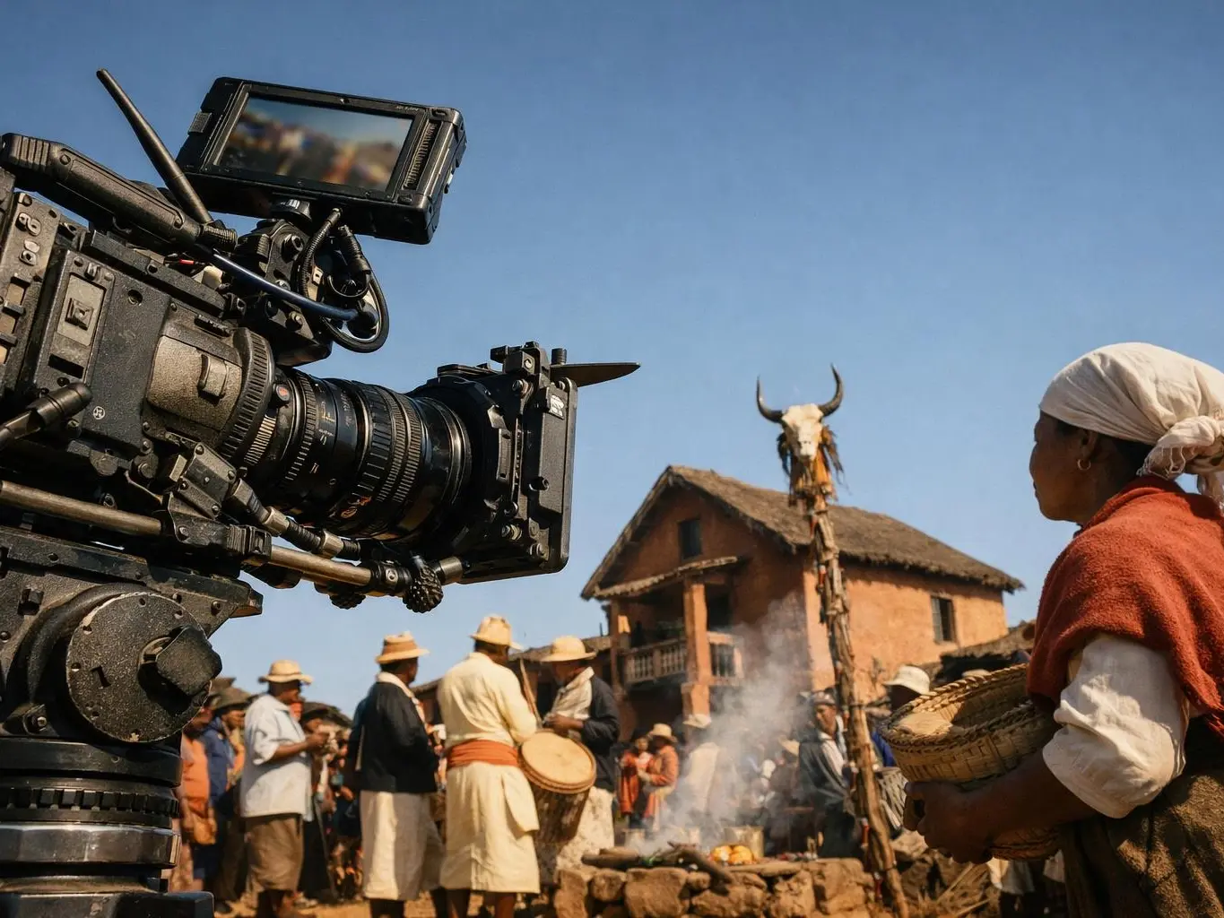
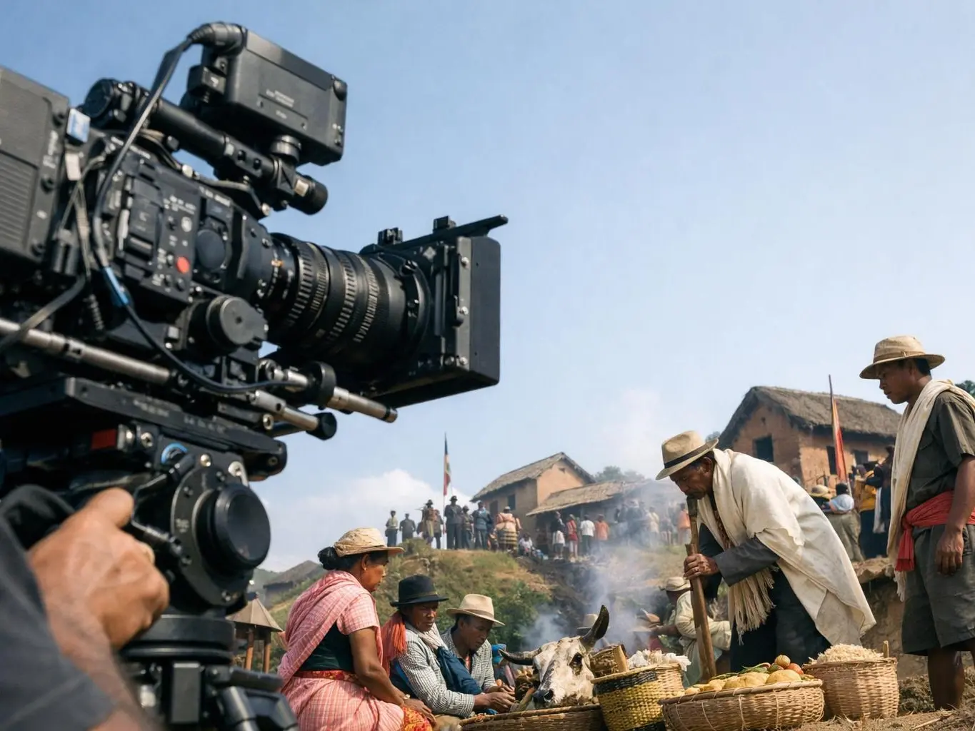
In Madagascar, where filming locations range from bustling cities to pristine national parks, flight plans help operators navigate diverse environments while adhering to local regulations. For example, a flight plan can ensure a drone avoids disturbing wildlife in protected areas or complies with altitude restrictions in urban settings. This level of planning is essential for productions that aim to capture Madagascar’s unique landscapes while minimizing environmental and legal risks.
A drone flight plan is not just a route—it’s a safety net. In Madagascar’s diverse filming locations, unexpected obstacles like wildlife or sudden weather changes can disrupt even the best manual piloting. A well-designed plan accounts for these variables, ensuring smooth operations and reducing the risk of costly mistakes.
A team filmed in Isalo National Park in Madagascar. They used a drone flight plan. The plan had spots at different heights for a wide shot. The camera angles were set to show the canyon rocks. The plan also checked wind to keep shots steady.
PRO FIXERS MADAGASCAR
Contact PRO FIXERS MADAGASCAR for practical guidance on Drone flight plan and related film production madagascar work in Madagascar.